Driving to Napier, you go through a town called Tirau. This town is famous for it's two converted barns, so here they are the "Dog" and "Sheep"
 The Sheep is actually a Merino clothing store now
 Good old New Zealand road sign
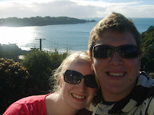
 Jenn in Taupo, Mt. Ruapehu and Lake Taupo in the distance
 In Taupo, McDonald's has fly-through
 Waterfall along highway 5 between Taupo and Napier
 The Pulp and Paper Industry is big in New Zealand, here is a clear cut area with new saplings growing.
 Jim with one of the many views along the way
 Another gorgeous view off highway 5
 Classic New Zealand road sign, sharp corner
 This one is for Buffy
 Jenn at Bluff Hill in Napier, the tallest point in the City
Looking out at Hawke's Bay and the Napier Coast line
 Sunset over Napier
 This was inside the Hawke's Bay Museum, typical Maori Carvings of the local tribes
 In 1931, the city of Napier and the entire region (Hawke's Bay) was destroyed by a 7.8 magnitude earthquake. The collapses and ensuing fires killed 256 people. The figure would later rise to 258 as two people were missing, presumed dead following the quake. Some 40 km² of today's Napier was undersea before the earthquake raised it. Here is a sign that was at the Train Station in Napier.
 Jenn in the gardens along Marine Parade
 The sphere in the garden was a gift from the Queen in remembrance of all the lives lost in the 1931 earthquake
 Famous Clocktower in Napier
 Pacu fish inside the National Aquarium
 Crocodile in the Aquaruim
 Our Hotel room at the Nautilus
 View from our balcony
 Yes that is in Celcius!
 Shark head washed up on the beach
 The beach in Napier is all pebbles, great for fishing
 Jim thinking about a swim...shark head detered him
 One of the most gorgeous places we have been. This range is called Te Mata Peak, it is 399m tall (1309 Feet). It is located outside of Havelock North which is 30 minutes south of Napier. The Maori Legend of this peak is;
Many centuries ago the people living in pa (fortified villages) on the Heretaunga Plains were under constant threat of war from the coastal tribes of Waimarama. At a gathering in Pakipaki (near Hastings), a wise old woman (kuia) suggested that the leader of the Waimarama tribes, a giant named Te Mata, could be made to fall in love with Hinerakau - the daughter of a Pakipaki chief - and turn his thoughts from war to peace. This mission was quickly accomplished, and Te Mata fell under the spell of the beautifully Hinerakau.
However the people of Heretaunga had not forgotten the past and wanted revenge. They demanded that Hinerakau make Te Mata prove his devotion by accomplishing seemingly impossible tasks. His last task was to bite through the hills between the coast and the plains, so that people could come and go with greater ease.
Te Mata died while eating his way through the hills. His half-accomplished work can be seen in what is known as The Gap or Pari Karangaranga (echoing cliffs) and his prostrate body forms Te Mata Peak.
 Such nice countryside below Te Mata Peak
 Livestock off the road
 Jim out in the country
 Te Mata peak from another vantage point
 Jenn with Te Mata Peak
 Jim outside Craggy Range Winery
 Jim with our Rental parked it beside a transit at the top of Te Mata peak. Some of the scariest driving Jim has ever done
 Road going back down, do you see any guard rails? We didn't either
 Looking down on the Hawke's Bay Region
 The next few photos are all views from the top of Te Mata
 Craggy Range Winery below


 Jim taking a good look at what a 1300 foot cliff looks like
 This one is for anyone who ever doubts the ability of a ford transit

 Church Road Winery, one of the oldest in New Zealand
 Jenn outside the original building at Church Road built in 1897
 Going up the road to Mission Estate Winery. This is the oldest Winery in the Country founded in 1851.
 Front of the winery
 Jenn with a fountain in the wineries courtyard
 Jim taking a look at all the vines growing in the distance
 Coutyard at Mission Estate winery. Lionel Ritchie will be playing a showed here in February


 Chuch in Napier
 Jenn with the smallest car we have ever seen. It was a Fiat
 When the town centre was destroyed by the 1931 Earthquake it was rebuilt in the popular Art Deco Style. Although a few Art Deco buildings were replaced with contemporary structures during the 1960s, 1970s and 1980s, most of the centre remained intact for long enough to become recognized as architecturally unique, and from the 1990s onwards had been protected and restored. Napier and South Beach (Miami) are considered by many Art Deco enthusiasts the two best preserved Art Deco towns, Miami Beach being mainly in the later Streamline Moderne Art Deco style. As of 2007, Napier has been nominated for UNESCO World Heritage Site status, the first cultural site in New Zealand to be nominated.
The next few photos are of the Art Deco Buildings in Napier


 I thought this was an interesting combination
 Main shopping strip in the city


 This bandshell is one of the most photographed structures in the city, it is right on Marine Parade which runs runs right beside the ocean
 Cruise ship in the distance, Diamond Princess
 Cape Kidnappers in the distance is at the southern end of Hawke Bay, on the east coast of the North Island. The name Kidnappers refers to an incident during Cook's first voyage when an attempt was made to trade with the occupants of an armed canoe. Tiata, the Tahitian servant of Tupia, Cook's interpreter, was seized by the Maoris and escaped by jumping into the sea when the canoe was fired on. The cape was named to commemorate the event; Sunday, 15 October 1769.
The cape lies 7 miles by coastal route, negotiable between tides on foot or bicycle, from Clifton at the far eastern edge of the Heretaunga (Ahuriri) Plains. There is also an inland route which passes through private farm land. The high plateau area between Kidnappers and Clifton is deeply gullied and accessible from the shore by a few routes only. The cliffs behind the beach are vertical and largely unclimbable. The plan shape of the cape is an acute-angled triangle. It is flat, probably a sea-cut bench at a height of between 200 and 300 ft, rising moderately steeply at its inland edge. It is composed of Lower Pliocene (Opoitian) blue-grey sandy mudstone, with large irregular calcareous concretions.
The cape is the site of a thriving gannetry which has grown in numbers in the last few years to the point that nesting now occurs as far as the inland edge of the rising slope from the cape plateau, and outlying colonies nest on the stacks of nearby Black Reef. The gannetry is administered by a domain board and permits to visit it are issued by the Commissioner of Crown Lands, Napier.
The Maori name for Cape Kidnappers is Mataupo Maui – the fish hook of Maui. Another less common name is Tapuwaeroa – the long footsteps. These, according to legend, were made by the giant Rongokako who left other impressions of his feet at Mahia and East Cape.
 Fountain along Marine Parade
 Jim puting his feet in Lake Taupo on the way back to Auckland
 Mt. Ruapehu across Lake Taupo, it erupted in 1995 and 1996
 Sign when you start the walk around "Craters of the Moon"
 Jenn with a large volcanic crater
 This area is extremely thermally active
 Another Crater smoking and steaming

 Mud Pool

 Lots of Native Ferns around the area
 View from the lookout at "Craters of the Moon"
 Neat Mountain on the drive back to Auckland
 Countryside near Matamata where Peter Jackson shot most of the Lord of the Rings Trilogy. We now know why they call this country "land of the long white cloud"